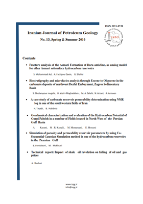
• List of Articles


      • Open Access Article

        1 - Fracture analysis of the Asmari Formation of Dara anticline, as analog model for other Asmari subsurface hydrocarbon reservoirs
        saeed mohammadi asl Ali Farzipour Saein Ghodratollah Shafiei
        The quality of the Asmari Formation, as the reservoir rock of almost three-quarters of the explored oil In Southwest Iran, is often affected by the fractures system. In this paper, in order to study fracture patterns in the Asmari Formation, as well as to present an ana More
        The quality of the Asmari Formation, as the reservoir rock of almost three-quarters of the explored oil In Southwest Iran, is often affected by the fractures system. In this paper, in order to study fracture patterns in the Asmari Formation, as well as to present an analog model for other Asmari reservoirs, the Dara anticline in South Dezful depression, which has extensive outcrops of the Asmari Formation, has been studied. During field studies, eleven stations on the anticline, in its different structural positions, have been investigated. In the southwestern limb, four fracture sets trending AZ40-50,AZ130-140,AZ10-20,AZ80-90, in the northeastern limb four fracture sets trending AZ130-140,AZ50-60,AZ170-180,AZ110-120, and in its hinge area, three fracture sets with AZ50-60,AZ130-140,AZ0-10 trends have been identified. From the structural perspective, all the identified fracture sets are associated with folding. In this study, the relative formation time of the identified fractures relative to folding, has been diagnosed as before or simultaneously with folding. Based on field studies, fractures density in the Dara anticline, the Asmari outcrop, ranges from 11.75 to 2 fractures per meter. Indeed, variation range of the fracture length is 1 to 25 m and most fractures have a length of lower than 5 meters. Also, in this study it was found that there is a negative logarithmic relationship between fracture density and sedimentary layers thickness. Manuscript profile
      • Open Access Article

        2 - Geochemical characterization and evaluation of the hydrocarbon potential of Gurpi in a number of fields Located in North West of Persian Gulf
        MohhamadReza Kamali محمود  معماریانی Ehsan Hosseni Arezoo Karami
        The results obtained from Rock-Eval pyrolysis and measurement of TOC showe that Gourpi and Pabdeh formations in Binak well show that Source rock does not have the sufficient organic material to produce hydrocarbons. However,Gourpi and Pabdeh in formations Hendijan and More
        The results obtained from Rock-Eval pyrolysis and measurement of TOC showe that Gourpi and Pabdeh formations in Binak well show that Source rock does not have the sufficient organic material to produce hydrocarbons. However,Gourpi and Pabdeh in formations Hendijan and Doroud wells support the organic material to produce hydrocarbons and are placed in a more appropriate stage in terms of production. Samply from Binak Lack Contamiaton and or staining Lokite Source rock Samples from Hendigan and Doroud wells show contamination and Staining to migration from other interuals. Source rock show type II taype II-III in Binak and which the samples are n ot fully matured (the end of diagenesis) and the Kerogen for Source rock type of in Hendijan and Doroud wells is II and II-III respectively traversing maturing pathway by reaching catagenesis stage and reaching at the beginning of oil generation window. In terms of the type of organic matter, most in studay wells are located in oil zone and the maximum production potential is associated with Doroud well Location so that it could serves as a production source rock. Although, the Hendijan well have high yield potential, due to failure to reach to oil generation window it fails in producing oil. Sedimentation in the Binak well is done quickly and in oxidized condition and OM preserved partially. The Hendijan and Doroud wells show medium sedimentation in restricted condition and quick sedimentation in oxidizing environment respectively indicating Marine depositinal environment Manuscript profile
      • Open Access Article

        3 - Simulation of porosity and permeability reservoir parameters by using Co-Sequential Gaussian Simulation method in one of the oil field in the South West of Iran
        Bahareh Fereidooni Mohammad Mokhtari
        Three-dimensional study of petrophysical parameters of hydrocarbon reservoirs such as porosity and permeability is considered as an efficient and effective tool for comprehensive study of reservoirs as well as reservoir management. In this study, which was carried out o More
        Three-dimensional study of petrophysical parameters of hydrocarbon reservoirs such as porosity and permeability is considered as an efficient and effective tool for comprehensive study of reservoirs as well as reservoir management. In this study, which was carried out on one of the oil fields in the southwest of Iran, the aim is to simulate the petrophysical parameters of effective porosity and permeability by using Co-Sequential Gaussian Simulation in part of Khatiyah reservoir. With this simulation, a three-dimensional model of petrophysical reservoir parameters can be presented which is important for simulating fluid flow and identifying areas that are prone with higher reservoir quality. For this purpose, effective porosity and permeability logs of seven wells with 3D seismic data and seismic inversion results have been used. After reservoir gridding and creating a structural model, up scaled petrophysical data has entered to model and its own cell. For three-dimensional distribution of effective porosity parameter, due to the correlation of effective porosity and acoustic impedance attribute of seismic inversion, 3D seismic data and up scaled effective porosity logs as the initial data and acoustic impedance attribute of seismic inversion as secondary data have entered in Sequential Gaussian Simulation. In order to simulate permeability, due to the good correlation between effective porosity simulation model and permeability log, simulated porosity as a secondary data and up scaled permeability and 3D seismic data as secondary data have been used. The results of validation indicate the accuracy of the present study and the efficiency of Sequential Gaussian Simulation method in effective porosity and permeability modeling in this reservoir. Manuscript profile
      • Open Access Article

        4 - A case study of carbonate reservoir permeability determination using NMR log in one of the southwestern fields of Iran
          Bahram Habibnia
        Permeability is one of the most important parameters for characterization of hydrocarbon reservoirs that has a basic role in almost all of the petroleum engineering problems. Determination of reservoir permeability is usually done in core laboratories in a time consumin More
        Permeability is one of the most important parameters for characterization of hydrocarbon reservoirs that has a basic role in almost all of the petroleum engineering problems. Determination of reservoir permeability is usually done in core laboratories in a time consuming process. In the well test, the obtained average permeability is related to the drainage area. Due to cost, these two methods are not performed in the all wells, whereas well logging tools are generally performed in all wells. With progress of well logging tools, some researchers tried to estimate permeability from special well logs such as NMR directly. The data obtained from NMR was used as lithology independent data to estimate the water saturation and porosity, and also for analysis of pore space. One of the important parameters obtained from NMR is the transversal relaxation time (T2). In this work, NMR log measurement in a carbonate field was used to estimate the permeability using Timur, SDR and regression models. The results of the methods were compared against core permeability. The results show that SDR method is more accurate with the accuracy of 44.1% and the error of 23.12%. Manuscript profile
      • Open Access Article

        5 - Biostratigraphy and microfacies analysis of the Shahbazan and Asmari formations (through Eocene to Oligocene) in the carbonate deposits of northwest Dezful Embayment, Zagros Sedimentary Basin
        sepedeh Gholampoor-moghahi Hosyen Vaziri moghadam Naser Arzani Afshin Armoon
        Abstract In this research based on petrography study of 320 thin sections (cutting samples), biostratigraphy, microfacies and depositional environment analysis has been done to determine the boundary between the Shahbazan and Asmari formations in well No. 1 of the Bala More
        Abstract In this research based on petrography study of 320 thin sections (cutting samples), biostratigraphy, microfacies and depositional environment analysis has been done to determine the boundary between the Shahbazan and Asmari formations in well No. 1 of the Balarud Oil Field, located in the north of Dezful embayment. The Shahbazan Formation with 460 meters thick with mainly composed of dolomite along with interlayers of limestone, shale and anhydrite in the studied well. The lower boundary of this formation with the Pabdeh Formation is conformable and its upper boundary with the Asmari Formation is marked by an unconformity. The Asmari Formation with thickness of 140 meters mainly consists of limestone and shale with the interlayers of dolomite; its upper boundary to the Gachsaran Formation is conformable. Biostratigraphy studies documented a high diversity of shallow-water benthic and rare planktonic foraminiferas and led to the determining of one assemblage zone in the Shahbazan Formation (15 genera and 8 species) that indicates age of the Priabonain. Three assemblage zones also were recognized in the Asmari Formation (12 genera and 8 species) that, shows the age of the Asmari Formation from Mid-Rupelian to the Chattian, Aquitanian and Burdigalin. Based on biostratigraphy studies, the boundary between Shahbazan and Asmari formations and the position of an unconformity between them were determined. The facies analysis led to recognition of eight microfacies for the Shahbazan Formation which belong to three facies belts of inner (tidal flat and lagoon), middle and outer ramp, deposited on a ramp-type carbonate platform. Also four microfacies were recognized in the Asmari Formation which are related to the inner carbonate platform. Manuscript profile
      • Open Access Article

        6 - Impact of shale oil revolution on falling of Oil and Gas prices Technical report
        Ali reza Bashari
        The rapid development of shale gas resources in the US has transformed the world gas-market outlook. Despite this, the consensus was for a long time that shale gas would not be a ‘game changer’ in the world as it has been in the US. Shale gas is extracted from solid roc More
        The rapid development of shale gas resources in the US has transformed the world gas-market outlook. Despite this, the consensus was for a long time that shale gas would not be a ‘game changer’ in the world as it has been in the US. Shale gas is extracted from solid rock using a process called hydraulic fracturing, or ‘fracking’. Static shows, in USA, production rates decline, for the most of well on average, 80 0r 85 percent over the three years. In order to maintain current level of shale gas production, Hughes estimates that the high rates of deterioration of such wells across the US will require the drilling of 7,000 new wells a year at cost of $42 billion annually. For the maintenance of overall production of shale oil, some 6,000 new wells would need to be drilled every year, an endeavor that would cost $ 35 billion. A number of environmental concerns have been raised about fracking, including the potential for seismic events, air pollution, surface and groundwater contamination, and greenhouse gas emissions. There is no doubt that shale revolution has been a game-changer in short term, but the implication shows that it is not sustainable in long-term. Manuscript profile