• XML

    isc pubmed crossref medra doaj doaj
  • List of Articles


      • Open Access Article

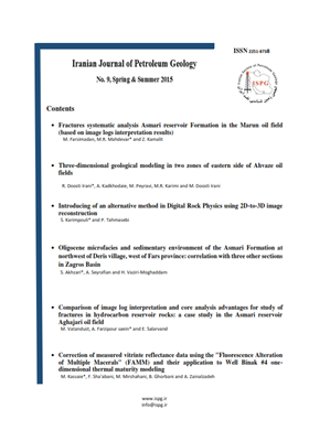
        1 - Fractures systematic analysis Asmari reservoir Formation in the Marun oil field (based on image logs interpretation results)
        فارسی مدان arsimadan
        In the oil buildings to investigate fractures in the reservoir rock fractures in stages of production and field development is very important and necessary. Now application of software repository in the realization of this issue will help to petroleum with the geologist More
        In the oil buildings to investigate fractures in the reservoir rock fractures in stages of production and field development is very important and necessary. Now application of software repository in the realization of this issue will help to petroleum with the geologists.. Marun oil field is one of the largest oil fields in the South West Iran of the city of Ahvaz in the Northeast and the North embayment Dezful of geology in the eastern. Marun field is the most important Asmari reservoir. The aim of this study was to investigate systematically Asmari reservoir fractures and the development of fractures in the reservoir. For this purpose, using image logs, best and most complete method interpretation and results of 11 wells in fracture studying and 16 wells in in-situ stress direction studying. According to frequency of fractures (based on image logs interpretation results) in the southern and north-eastern limb of the field, The theory of tectonic folding and bending events later caused the possible activities during the north-south strike-slip faults affect the compression force has been created to strengthen. Most of image logs data in Marun field are fractures with extensions; N155E, N130E, N95E, N60E, N30E. Manuscript profile
      • Open Access Article

        2 - Fractures systematic analysis Asmari reservoir Formation in the Marun oil field (based on image logs interpretation results)
        Zahra Kamali Mohammad reza Mahdevar meysam farsi madan
        In the oil buildings to investigate fractures in the reservoir rock fractures in stages of production and field development is very important and necessary. Now application of software repository in the realization of this issue will help to petroleum with the geologi More
        In the oil buildings to investigate fractures in the reservoir rock fractures in stages of production and field development is very important and necessary. Now application of software repository in the realization of this issue will help to petroleum with the geologists.. Marun oil field is one of the largest oil fields in the South West Iran of the city of Ahvaz in the Northeast and the North embayment Dezful of geology in the eastern. Marun field is the most important Asmari reservoir. The aim of this study was to investigate systematically Asmari reservoir fractures and the development of fractures in the reservoir. For this purpose, using image logs, best and most complete method interpretation and results of 11 wells in fracture studying and 16 wells in in-situ stress direction studying. According to frequency of fractures (based on image logs interpretation results) in the southern and north-eastern limb of the field, The theory of tectonic folding and bending events later caused the possible activities during the north-south strike-slip faults affect the compression force has been created to strengthen. Most of image logs data in Marun field are fractures with extensions; N155E, N130E, N95E, N60E, N30E Manuscript profile
      • Open Access Article

        3 - Fractures systematic analysis Asmari reservoir Formation in the Marun oil field (based on image logs interpretation results)
        meysam farsi madan Mohammad reza Mahdevar Zahra Kamali
        In the oil buildings to investigate fractures in the reservoir rock fractures in stages of production and field development is very important and necessary. Now application of software repository in the realization of this issue will help to petroleum with the geologi More
        In the oil buildings to investigate fractures in the reservoir rock fractures in stages of production and field development is very important and necessary. Now application of software repository in the realization of this issue will help to petroleum with the geologists.. Marun oil field is one of the largest oil fields in the South West Iran of the city of Ahvaz in the Northeast and the North embayment Dezful of geology in the eastern. Marun field is the most important Asmari reservoir. The aim of this study was to investigate systematically Asmari reservoir fractures and the development of fractures in the reservoir. For this purpose, using image logs, best and most complete method interpretation and results of 11 wells in fracture studying and 16 wells in in-situ stress direction studying. According to frequency of fractures (based on image logs interpretation results) in the southern and north-eastern limb of the field, The theory of tectonic folding and bending events later caused the possible activities during the north-south strike-slip faults affect the compression force has been created to strengthen. Most of image logs data in Marun field are fractures with extensions; N155E, N130E, N95E, N60E, N30E. Manuscript profile
      • Open Access Article

        4 - Three-dimensional geological modeling in two zones of eastern side of Ahvaz oil field
        Razeyeh . Doosti Irani Maryam Payrovi Mohammad .rahim karimi Mehdi . Doosti Irani
        The Ahvaz field is one of the most important oil fields in the Zagros Basin which is located in the Dezful Embayment. The trend of Ahvaz oil field is northwest- southeast parallel to the Zagros mountains. The purpose of this study is the geological 3D simulation (petrop More
        The Ahvaz field is one of the most important oil fields in the Zagros Basin which is located in the Dezful Embayment. The trend of Ahvaz oil field is northwest- southeast parallel to the Zagros mountains. The purpose of this study is the geological 3D simulation (petrophysical) for the zone one and two in the eastern part of the Ahvaz oil field. In this investigation, porosity modeling, water saturation and shale volume by using sequential Gaussian Simulation (SGS) was performed. At first, well logs, cores, well’s coordination, top and thickness of formations of the zone three of Ilam Formation and zone one of Sarvak Formation were collected. These information related to 25 wells in the eastern part of the Ahvaz oil field was used for the 3D modeling of the reservoir by using Petrel software. For the recognition of spatial correlation, variograms based on water saturation and permeability and three dimensional model of the petrophysical parameters and net to gross ratio (NTG) were drawn. Manuscript profile
      • Open Access Article

        5 - Introducing of an alternative method in Digital Rock Physics using 2D-to-3 D image reconstruction
        sadegh karim pouli sadegh karim pouli
        Digital Rock Physics (DRP) is a newly developed method to numerically compute rock physical properties such as permeability, elastic moduli and formation factor using highresolution 3D images of rock sample. These images are acquired using high technology µCTscanners More
        Digital Rock Physics (DRP) is a newly developed method to numerically compute rock physical properties such as permeability, elastic moduli and formation factor using highresolution 3D images of rock sample. These images are acquired using high technology µCTscanners which are not widely available. Imaging by this technique is also expensive and time consuming. However, improvement of 3D reconstruction algorithms such as CCSIM reconstruction method made it possible to be used effectively as an alternative strategy in DRP. In this paper, we propose an alternative procedure described as follow: 1. highresolution 2D imaging, 2. dividing the image to some sub-images, 3. 3D reconstructing of subsamples, 4. segmentation of porosity and mineral phases and, 5. computing of rock physical parameters. This method was implemented Berea sandstone formation. Obtained results show that, in one hand, average values of sub-samples properties follow a consistent trend with the reference trends of the rock sample. On the other hand, these trends pass the results presented by a previous work. Permeability results, however, show bi-trending. Investigation in sub-images revealed that there are two types of pore shape and pore throat size. To overcome this problem, 2D image were resampled and more representative subimages were generated. According to these results, it can be concluded that this is a valid method where an alternative method for standard Manuscript profile
      • Open Access Article

        6 - Oligocene microfacies and sedimentary environment of the Asmari Formation at northwest of Deris village, west of Fars province: correlation with three other sections in Zagros Basin
        samir Akhzari Ali Seyrafian
        In this disquisition, Oligocene (Rupelian-Chattian) microfacies and sedimentary environment of the Asmari Formation at the northwest of Deris village, located in interior Fars zone of the Zagros Basin have been interpreted. The coordinates of such section are N: 29o 4 More
        In this disquisition, Oligocene (Rupelian-Chattian) microfacies and sedimentary environment of the Asmari Formation at the northwest of Deris village, located in interior Fars zone of the Zagros Basin have been interpreted. The coordinates of such section are N: 29o 41' 59'', E: 51 o 32' 26''. The Asmari Formation deposits in this section are divided into 5 lithological units and consist of 460 m thin, medium, thick and massive bedded, gray and cream to gray limestone, slightly dolomitic with nodular and marly interbedded. By study of hyaline benthic foraminifera genera and non-foraminifera, and also recognition of some properties such as skeletal ingredient associations and sedimentary textures of thin sections, 14 microfacies have been introduced for the Asmari Formation. Gradual perpendicular changes of these microfacies represent that settling the Asmari Formation deposits took place in a homoclinal rapm. This homoclinal ramp consists of middle ramp and inner ramp, that are separated by shoal environment. Middle ramp is recognized by presence and dominition hyaline benthic foraminifera, coralline red algae and echinoids. The most significant skeletal debris of inner ramp are porcelainous foraminifera. To compare the thickness, age and sedimentary environment, zonal correlation of the Asmari Formation done in Deris section with three other sections (Naura anticline, Dill anticline and Dehloran) in the Zagros Basin. This correlation represent that the age of the Asmari Formation gets younger to the deeper parts of the foreland basin of the Zagros. Manuscript profile
      • Open Access Article

        7 - Comparison of image log interpretation and core analysis advantages for study of fractures in hydrocarbon reservoir rocks: a case study in the Asmari reservoir Aghajari oil field
        Masumeh Vatan dust Ali Farzipour Saein Esmaeil Salarvand
        The Oligo-Miocene Asmari Formation is one of the main reservoir rocks of SW Iran with several decades of production history from different oil fields in the Zagros fold- thrust belt. One of the main reasons for the high quality of the Asmari reservoir is well develope More
        The Oligo-Miocene Asmari Formation is one of the main reservoir rocks of SW Iran with several decades of production history from different oil fields in the Zagros fold- thrust belt. One of the main reasons for the high quality of the Asmari reservoir is well developed fracture system in this formation. Characteristics of fractures such as type, opening and orientation can be determined by the core analysis and also interpreting the image logs. This paper attempts to compare the advantages of the image log and core analysis in detecting fractures and other geological feathers in different zones of the Asmari Formation. To achieve this goal, we have compared the image log and core of well no. 89 of the Aghajari oil field. Comparison of the core well no. 89 of the Aghajari oil field with its image log revealed distinguish of the bedding planes in the core easier and more reliable than the image log. This study demonstrates the image log is more capable than core to detect the open fractures, while it is not suitable for detecting filled fractures. Indeed, image log rarely can detect shear fractures, but if it is calibrated with core, it can detect shear fractures with reasonable accuracy. Manuscript profile
      • Open Access Article

        8 - Correction of measured vitrinte reflectance data using the "Fluorescence Alteration of Multiple Macerals" (FAMM) and their application to Well Binak #4 one-dimensional thermal maturity modeling
        Mohammad KassaieNajafi Faramarz Shabani Maryam Mirshahani Beyok Ghorbani Arsalan Zenalzadeh
        Reflectance of maceral constituents of kerogens, particularly vitrinite (Ro%), commonly used in petroleum exploration, is a very important indicator for determining degree of thermal maturity and investigating status of hydrocarbon generation. Although in vitrinite r More
        Reflectance of maceral constituents of kerogens, particularly vitrinite (Ro%), commonly used in petroleum exploration, is a very important indicator for determining degree of thermal maturity and investigating status of hydrocarbon generation. Although in vitrinite reflectance profiles maturity generally increases with increasing depth of burial, basin modelers often experience problems when modeling thermal maturity using vitrinite reflectance data measured by using reflected light- photometer microscopes. The problem of reduced vitrinite reflectance mainly arises due to reflectance suppression in vitrintes. By using the laser Raman microprobe, a new multi-parameter technique called "Fluorescence Alteration of Multiple Macerals (FAMM)" was developed by Australian scientists to solve these problems. In this study, data obtained by application of this method were used to correct suppressed vitrinite reflectance values. In order to examine and demonstrate the extent of suppression effect on modeling results, maturity profile constructed by one-dimensional modeling of Well Binak-4 was calibrated using conventional measured vitrinite reflectance (Ro%) and FAMM equivalent vitrinite reflectance (EqVR) data and results were compared with present time measured well temperatures. The crucial differences in maturation, transformation ratio, hydrocarbon generation and expulsion resulted from application of these two type data as calibration parameters are discussed and demonstrated using relevant diagrams. Manuscript profile