• OpenAccess
    • List of Articles Petrophysics

      • Open Access Article

        1 - Study of Petrography & Petrophysics of Permian- Triassic carbonate sediments in Qatar –South Pars Arch
        Ali reza Bashari
        Abstract Dalan and Kangan Formations are major gas reservoirs in the Persian Gulf and surrounding area. Several supper giant gas fields has been found in the region. In this study reservoir rock types were identified and were divided into four lithostratigraphic zo More
        Abstract Dalan and Kangan Formations are major gas reservoirs in the Persian Gulf and surrounding area. Several supper giant gas fields has been found in the region. In this study reservoir rock types were identified and were divided into four lithostratigraphic zones: K1 to K4. Each of the four succeeding zones have been divided into different subzone. This Studies identified different facies-types on the Dalan and Kangan formation in this region. Petrophysical & Petrographycal studies indicate that the best reservoir unites are found in: Dolo-grainstones, Dolowakestones/Packstones and Grainstones. Isopach maps and Depth maps show variations in thickness and depth of different zones in this region. Depth map on top of Kangan formation shows this formation getting deeper toward north- west and south east in the Persian Gulf. Continuity of marker beds in Permian/Triassic sediment and paleontological evidence support diachroneity of these sediments. Manuscript profile
      • Open Access Article

        2 - Geochemical analysis &petrophysical studies: An approach to clay minerals investigation of E member of Qom Formation, Sarajeh gas field
        عباس دهکار سهیلا اصلانی
        Geochemical and petrophysical studies on E member of Sarajeh Gas field shows presence of different type of clay minerals. Petrography studies along with XRD , SEM and EDX analysis on the present samples, indicate presence of Illite, Chlorite and expandable clay mine More
        Geochemical and petrophysical studies on E member of Sarajeh Gas field shows presence of different type of clay minerals. Petrography studies along with XRD , SEM and EDX analysis on the present samples, indicate presence of Illite, Chlorite and expandable clay minerals. Expandable clays comprise, smectite and mixed layer or interstratified Illite/Smectite (I/S) minerals. Petrophsical studies show Th/K on NGS log in Sarajeh, well 12, composed mainly, Illite, chlorite with minor amount of interstratified Illite/Smectite (I/S). Geochemical studies confirm validity of petrophysical results. The presence of different clay minerals of Qom formation in E member, Sarajeh Gas field, may have significant impact on petrophysical properties of reservoir, and hence affect reservoir productivity as well as cause problem during drilling operations. Manuscript profile
      • Open Access Article

        3 - Sedimentological studies and Petrophysical interpretation: An approach to reservoir characterization of Sarvak formation in the Dalpari oil field
        علی اصغر عنایتی
        The Ilam and Sarvak Formations of Bangestan Grouop are the second important potential reservoirs after Asmari formation in the zagros basin. Integration of petrographical factors and Petrophysical parameters resulted in better understanding of reservoir qualities of More
        The Ilam and Sarvak Formations of Bangestan Grouop are the second important potential reservoirs after Asmari formation in the zagros basin. Integration of petrographical factors and Petrophysical parameters resulted in better understanding of reservoir qualities of these formations. In this study , 250 thin sections were collected and subjected to microfacies and petrography studies. As a result eight microfacies from three sedimentary environments were identified: Lagoonal (L1 ,L2 ,L3),Barrier (B1 ,B2) and Open marine (O1 ,O2 ,O3) and in three different of digenetic environments such as marine, meteoric and burial. This Study shows Sarvak Formation is being formed on Carbonate Rimmed shelf platform. Petrophysical interpretations by using of IP software shows Sarvak reservoir is divided into 3 zones (4, 5, 6). This study reveals that zone 4 contains the best reservoir quality in compare with the others by having (17m) oil column. porosity (more than 8%) and water saturation less than(14%) in this field. There is also decreasing of water saturation in Pay zone 4, but no significant changes has been observed through out zones 5&6. In zone 4, shale volume increases in zones 5&6 (Vsh more than 25%). Crossplot K-Th and K-Pe reveals that Chlorite_Montmorilonite are the dominant clay minerals in this reservoir. Manuscript profile
      • Open Access Article

        4 - Sedimentological studies and Petrophysical interpretation: An approach to reservoir characterization of Sarvak formation in the Dalpari oil field
        Abolhasan Ahan kar Abolhasan Ahan kar
        The Ilam and Sarvak Formations of Bangestan Grouop are the second important potential reservoirs after Asmari formation in the zagros basin. Integration of petrographical factors and Petrophysical parameters resulted in better understanding of reservoir qualities of t More
        The Ilam and Sarvak Formations of Bangestan Grouop are the second important potential reservoirs after Asmari formation in the zagros basin. Integration of petrographical factors and Petrophysical parameters resulted in better understanding of reservoir qualities of these formations. In this study , 250 thin sections were collected and subjected to microfacies and petrography studies. As a result eight microfacies from three sedimentary environments were identified: Lagoonal (L1 ,L2 ,L3),Barrier (B1 ,B2) and Open marine (O1 ,O2 ,O3) and in three different of digenetic environments such as marine, meteoric and burial. This Study shows Sarvak Formation is being formed on Carbonate Rimmed shelf platform. Petrophysical interpretations by using of IP software shows Sarvak reservoir is divided into 3 zones (4, 5, 6). This study reveals that zone 4 contains the best reservoir quality in compare with the others by having (17m) oil column. porosity (more than 8%) and water saturation less than(14%) in this field. There is also decreasing of water saturation in Pay zone 4, but no significant changes has been observed through out zones 5&6. In zone 4, shale volume increases in zones 5&6 (Vsh more than 25%). Crossplot K-Th and K-Pe reveals that Chlorite_Montmorilonite are the dominant clay minerals in this reservoir. Manuscript profile
      • Open Access Article

        5 - Al Khalij field in Qatar, and extension toward Reshadat Oil Field, in the Persian Gulf
        Ali reza Bashari
        Alkhalij field located offshore Qatar , was discovered in 1991 and put into production in 1997. The field is original in many aspects. it is one of the few carbonate reservoir with stratigraphic closure, the oil is being trapped in upper part of a monocline due to a l More
        Alkhalij field located offshore Qatar , was discovered in 1991 and put into production in 1997. The field is original in many aspects. it is one of the few carbonate reservoir with stratigraphic closure, the oil is being trapped in upper part of a monocline due to a lateral variation in reservoir facies. In addition, the reservoir lies within the capillary transition zone and consists of a succession of highly conductive oil bearing layers ( drains) in between matrix layers of poor permeability. High- resolution 3D seismic has revealed additional area developed, which were previously considered to be uneconomic. Resent 4D seimic pilot has given encouraging result to utilize Seismic Technologies to analyse the evolution of the Al Khalij oilfield over time. Studies shows, this field possibly extended toward Reshdat oil field. Manuscript profile
      • Open Access Article

        6 - Integration of petrophysical and Seismic data: an Attempt to Geological model, Ilam reservoir oil field, Sirri District , in the Persian Gulf.
        Alireza Bashari
        Ilam Formation is deposited at the late Cretaceous (Santonian) in a neritic/pelagic environment. Following the Ilam deposition, a general deepening has occurred and the Gurpi formation (shaly layer) was deposited. Ilam has thickness variation between 75-110m and st More
        Ilam Formation is deposited at the late Cretaceous (Santonian) in a neritic/pelagic environment. Following the Ilam deposition, a general deepening has occurred and the Gurpi formation (shaly layer) was deposited. Ilam has thickness variation between 75-110m and structure has created as a result of upward movement of deep seated salt. Ilam reservoir in this field is regarded as a secondary hydrocarbon potential, and since now, no oil has been produced from this horizon. petrophysical and Seismic interpretation has been done for the Ilam reservoir, the geological models (structural and property models) are generated, with both deterministic and stochastic approaches. The seismic attributes as secondary variables, improved the kriging and Sequential Gaussian Simulation (SGS) algorithm results for modeling of Ilam. This study reveals that Water Saturation is generally high, indicating that Ilam reservoir has low hydrocarbon potential, within the five reservoir potential zones, the zone 5 indicated a good original oil in place potential, especially in the western and central parts of the field. Manuscript profile
      • Open Access Article

        7 - Petrophysical Modeling of Lower Zone of Ratawi Formation, using Neural Network Method in Assimilating Seismic and Geological Well Log Data
        Javid Hanachi Alireza Bashari
        Esfandiar field is located at the northern part of the Persian . This field is a single large anticline with Lulu field of Saudi Arabia, with , 20 KM length and 7 KM width. The field was discovered in 1966 by drilling of well E1, on the northern culmination of t More
        Esfandiar field is located at the northern part of the Persian . This field is a single large anticline with Lulu field of Saudi Arabia, with , 20 KM length and 7 KM width. The field was discovered in 1966 by drilling of well E1, on the northern culmination of the field. wells E3 and E2 were drilled at the top of structure in the southern part of the field. DSTs tests results of E1 proved that the top of Lower Ratawi formation contain 15 m oil column. E3 well test result regards as a dry hole DSTs test results of E2 were not conclusive due to inadequate testing plans . E4 Appraisal well contained, 14 m oil column at the Lower Ratawi. Log interpretations results indicated, E2 and E3 wells contains oil in Yamama formation in the southern part of the field which has not been tested properly. Lower Ratawi (Top oil-bearing zone ), Zone 'B' of Lower Ratawi (Oil bearing zone at bottom), Yamama were constructed based on the existing data. Petrophysical and geophysical data has been used for the Lower Ratawi reservoir, as a result the geological models (structural and porosity models), with applying, related software’s and neural network geophysical method are generated . At the conclusion, the recommended plan consists of horizontal drilling wells for oil production in Lower Ratawi in the north of the field has been proposed. Manuscript profile
      • Open Access Article

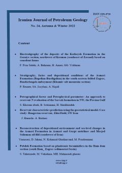
        8 - Petrographical factor and Petrophysical parameter: An approach to reservoir evaluation of the Sarvak formation in NW, of the Persian Gulf
        Alireza Bashari
        Sarvak formation is a major oil reservoir in the Persian Gulf. Various nomenclature of the Sarvak formation were applied by different operative oil companies In the northern part of the Persian Gulf. The aim at this study is to harmonize stratigraphical nomenclatu More
        Sarvak formation is a major oil reservoir in the Persian Gulf. Various nomenclature of the Sarvak formation were applied by different operative oil companies In the northern part of the Persian Gulf. The aim at this study is to harmonize stratigraphical nomenclature in this district , as well as to study the reservoir qualities and to asses hydrocarbon accumulations in this area. By using different petrophysical data and integration with geological factor, resulted in revealing three stratigraphy members ( Mishrif, Ahmadi and Mauddud), as well as reservoir qualities variations , in this district. By applying, available petrophsical data, and integration with geological information, various 3D geological maps, ( porosity, water & oil saturation maps etc…) were made. Preliminary assessment of the reservoir potential of the Bahregansar & Hendijan Fields shows , Sarvak formation in these two fields, have a good reservoir qualities, but other part of this district has poor reservoir qualities. This study shows , having high portions of clay mineral in the Sarvak reservoir along with lack of suitable cap rock and poor reservoir qualities , diminished reservoir potentials in this district. Manuscript profile